Site Overview
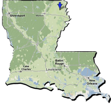 |
The Poverty Point site, which dates to approximately 1700- 1100 BC, is located in northeastern Louisiana in the Lower Mississippi Valley. It is situated on a ridge overlooking the Bayou Macon. The most distinctive feature of the site is the immense earthworks, including 6 concentric ridges forming a c-shape, and a number of large mounds (see site map with rollovers at the bottom of the page). To get an idea of the size of the site, click here to compare the size of the Poverty Point site to the URI campus. |
Over one million artifacts have been recovered from surface collections and excavations at the site so far (this does not include those smaller than 1 inch in size!). Archaeologists have systematically excavated less than 1% of the total area of the Poverty Point site. Over the course of the semester we will be discussing the different methods archaeologists have used to study the site, what they have learned so far, and what research is still needed. |
|
Why is it called Poverty Point?The site was named after the historic “Poverty Point” plantation located in the same area. Other plantations on the Macon Ridge had names such as “Lost Hope” and “Hard Times,” suggesting the farming techniques that were successful for the floodplain were not well-suited for the uplands. |
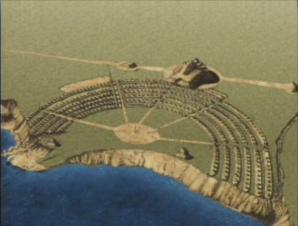 |
Interactive ActivityOver 30 million basket loads of soil (50 lbs each) were needed to construct the mounds and ridges at the Poverty Point Site. This activity provides more information on the features of the Poverty Point Site.
|
Reconstruction
by Jon L. Gibson |
|
Please watch the video “Poverty Point Earthworks: Evolutionary Milestones of the Americas” hosted by the Archaeology Channel Website for a brief introduction to the Poverty Point site. After watching the video, write down any questions you have about the site or things you would like to know more about. |
|
This page used information from entries
1, 2 and 3 in the Bibliography.
